

4FRI Springs Inventory and Monitoring

Tres Coyote Springs on Apache-Sitgreaves National Forest.
Over the next decade, large and complex landscape management treatments will be conducted on the Coconino and Kaibab National Forests in northern Arizona through the Four Forests Restoration Initiative (4FRI). These treatments will involve thinning of dense ponderosa pine forests and return of more frequent managed fires to create forest conditions closer to pre-settlement forest densities and fire frequency. These actions will reduce the likelihood of catastrophic wildfire, and provide more resiliency to climate change. Land managers, elected officials, academic scientists, recreationists and other forest visitors and residents, conservationists, Tribes and people across the Southwest who are concerned about catastrophic wildfire exacerbated by climate change all have great interest in the 4FRI restoration and partnership effectiveness.
Springs are widely regarded as important resources in arid regions, such as northern Arizona. They are excellent indicators of environmental change and are arenas in which many fields of environmental and social science converge. Yet few springs have been monitored or studied in detail in the state. Except for Montezuma Well and prominent springs in Grand Canyon, little information is available on the distribution, ecological integrity, flow perenniality, or other aspects of springs ecosystem ecology in Arizona.
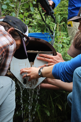
Workshop participants measure springs discharge using a weir plate.
Springs are likely to respond to land use changes, such as those planned in the 4FRI program. Reduced forest cover is anticipated to increase infiltration, and consequently the discharge of springs in the treatment area, but monitoring of these effects is needed. Most of the springs in these forests are small: monitoring springs flow or responses of these small areas of habitat is not feasible remotely, and requires novel approaches. The most cost-effective approach is through citizen science—involving students and members of the public to participate in monitoring. However, information management of data collected by a large number of participants at a large number of springs presents a great challenge.
This springs inventory and monitoring program seeks to test the effectiveness of 4FRI treatment and addresses the following questions: 1) How will the treatment affect springs ecosystems and influence aquifer recharge and; 2) Will the treatment improve springs ecological integrity? In collaboration with the Wildlands Network and Northern Arizona University, SSI has developed a springs monitoring field application (app) for smart phones and tablets, and we have published an online tutorial. As volunteers begin to collect data we will manage submitted information, assist the project inventory, and assess springs selected for more detailed investigations.

An example of the 4FRI springs monitoring app showing springs near Flagstaff, Arizona, Coconino National Forest.
With the generosity of ESRI and funding from the Nina Mason Pulliam Charitable Trust, SSI has developed the springs monitoring app using the ArcGIS Collector platform. This enables citizen science volunteers to use their smartphones and tablets while they collect and update valuable information in the field, with or without cellular coverage. Data collected through this app includes springs georeferencing, photos, and simple drop-down lists for users to include species accounts, water flow, habitat area, and other applicable information. Crowd-gathered data is uploaded to the SSI server where it undergoes quality assurance protocols by data technicians before being added into the springs online database (springsdata.org.) “By linking an innovative adaptation of smartphone-technology to citizen science, we will provide the 4FRI stakeholders with an effective and efficient way to assess the hydrological responses of forest restoration on springs ecosystems,” says Dr. Abe Springer, professor of Hydrogeology at Northern Arizona University.
This collaborative project provides new technology and analytical capacity to (1) educate managers and the public about the condition of springs and aquifers and their condition to large landscape restoration efforts and about the importance of springs to regional biodiversity and their potential role in wildlife movement, and (2) encourage crowd-based environmental information compilation. This effort also provides easy to use concepts and tools to improve inventory and assess the ecological integrity of these essential water resources, and will improve scientific and practical understanding, community collaboration, and ecosystem sustainability and stewardship.

Ms. Jeri Ledbetter with a University of Lethbridge researcher.
This exciting education and public outreach project will train volunteers who are interested in becoming springs stewards, provide tools to monitor and collect springs data, and engage the agencies in charge of managing these natural resources. Volunteers will attend training workshops to learn about springs ecosystems, their importance in the southwestern landscapes, and effective springs stewardship in conjunction with the Springs Inventory Protocols (SIP), Springs Ecosystem Assessment Protocols (SEAP), and the new springs monitoring app. If you are interested in having a great time surveying springs on the beautiful Kaibab and Coconino National Forests, then join us and become a volunteer in contributing to this exciting project.