

We deeply appreciate the support of the Esri Conservation Grant Program that has provided free software, training, reduced-rate software maintenance, and ArcGIS Online subscriptions over the past several years. Their generous contributions have supported our efforts to build an extensive geodatabase of springs across the west, and to publish online interactive maps and applications from our server. This capability allows us to better collaborate with partners, and to engage the public. For example, we have published online interactive maps of the Desert LCC and Southern Rockies LCC.
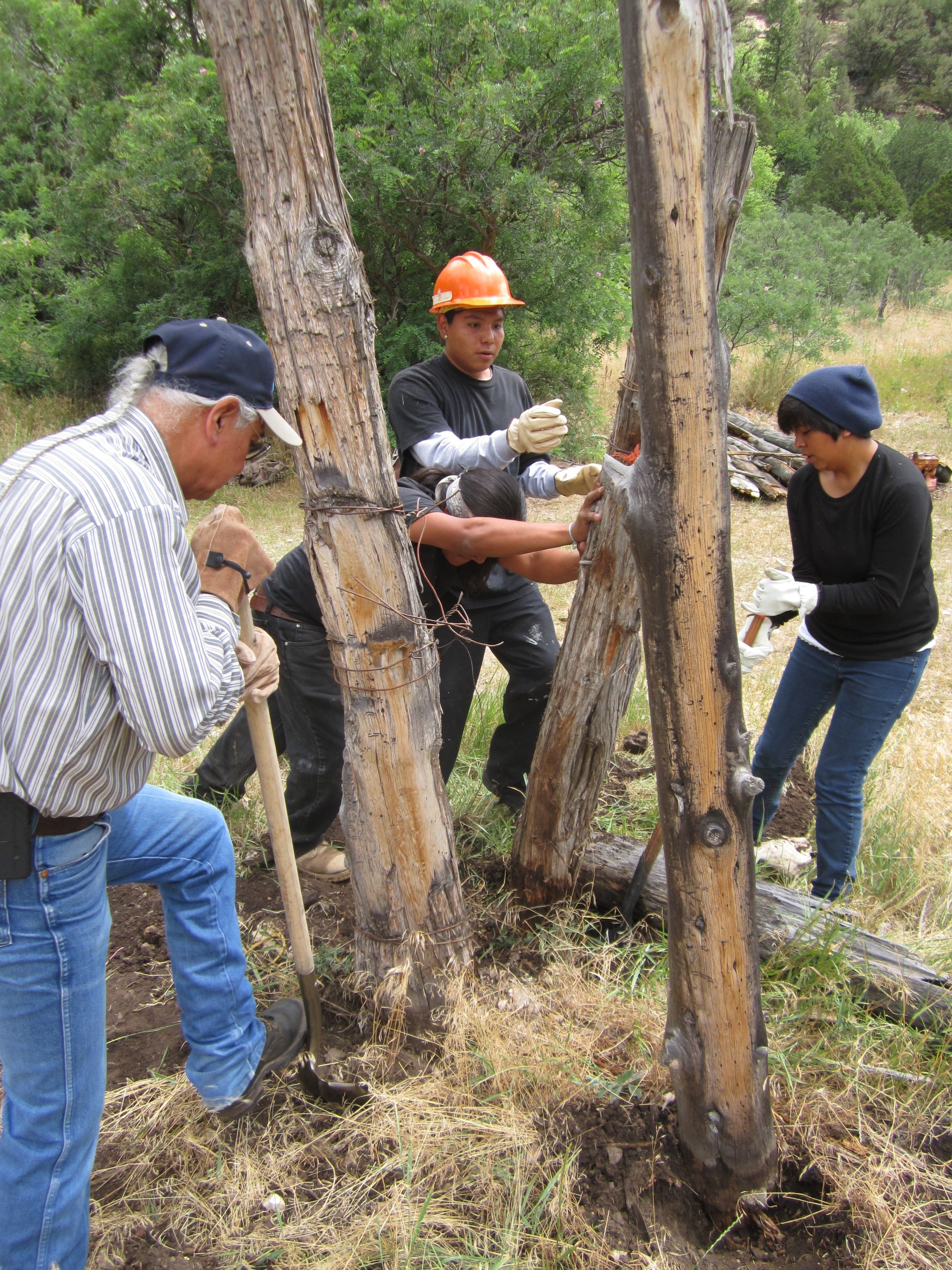
Volunteers removing decrepit fence posts during the rehabilitation of Castle Springs in Kaibab National Forest.
We work with partners on many levels, including NGOs, researchers, Native American Tribes, Universities, and Federal, State, and County agencies. We are currently working with several NGOs, including the Tuolumne River Trust, Sky Island Alliance, Grand Canyon Trust, and Wildlands Network. We have agreements with Kaibab, Coconino, and Apache-Sitgreaves National Forests to inventory springs and maintain the compiled data. We are also assisting five Native American Tribes with understanding the distribution and condition of their springs. Our online database now has more than 800 users, with new springs and surveys added every day.
We have developed many mapping applications, feature services, and story maps. Some are not available to the public due to sensitivity of the data (e.g. springs associated with archaeological sites or cultural resources). However, many are available online and showcase projects such as our Southern Rockies Landscape Conservation Cooperative, completed in September 2015, which includes springs distribution, climate predictions, and population change.
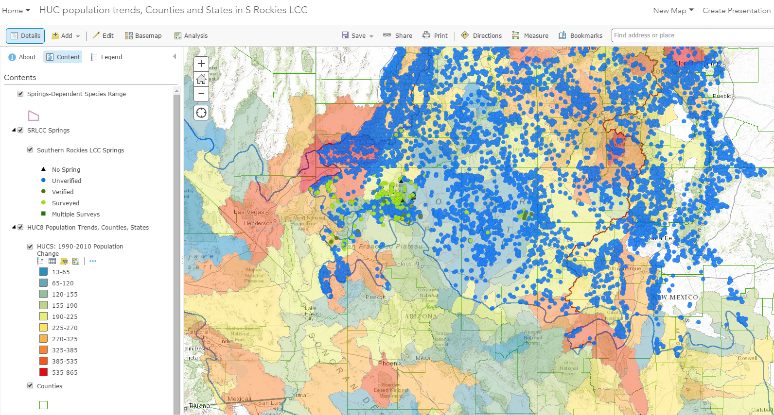
Interactive online map of publicly-available springs data and human population change within the Southern Rockies LCC. All data have been imported into the SpringsOnline database at http://springsdata.org/.
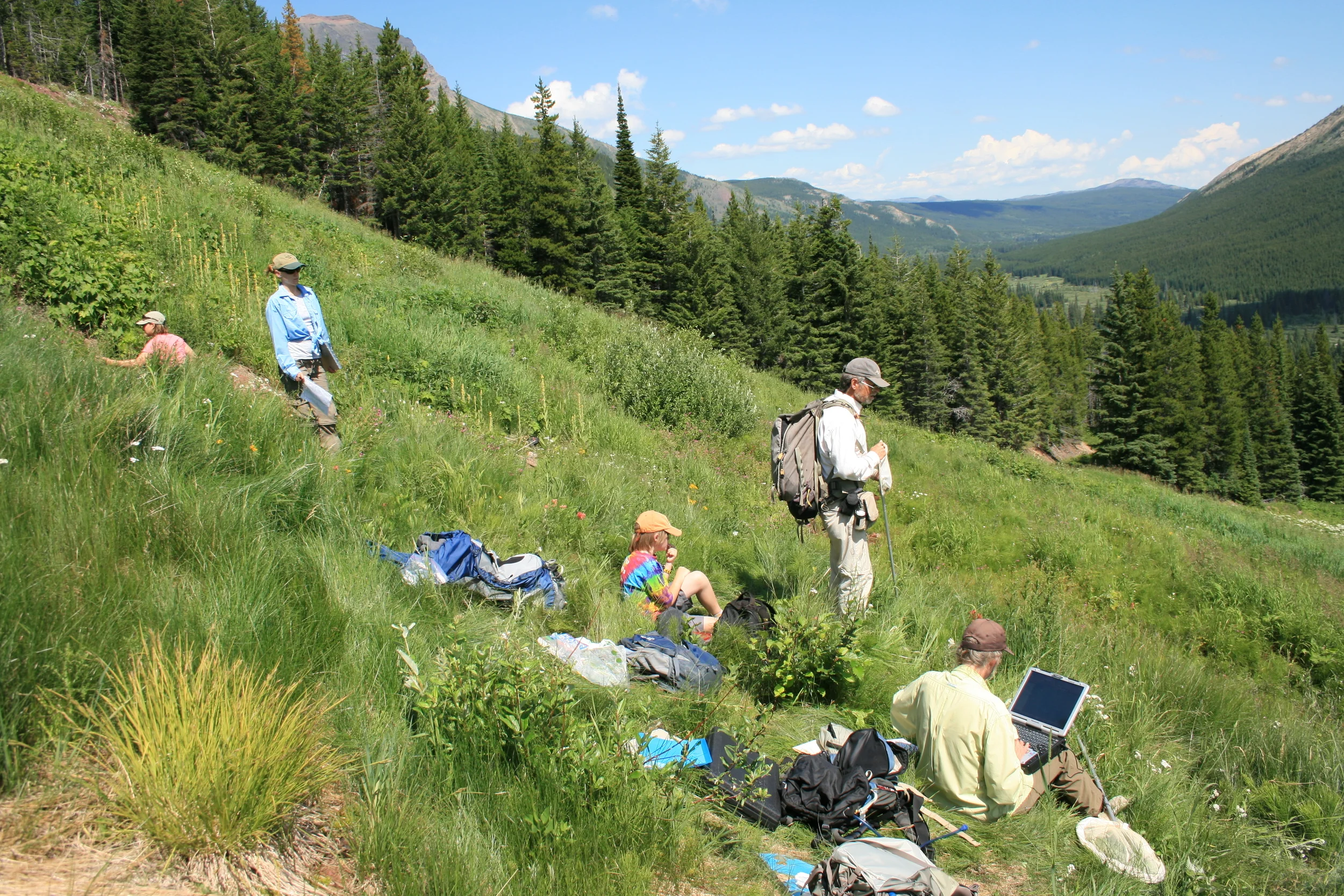
Ms. Jeri Ledbetter and Dr. Larry Stevens surveying Jellyroll Springs in Alberta, Canada with researchers from the University of Lethbridge, and in collaboration with Dr. Abe Springer of Northern Arizona University.
Although our focus has been on springs of the Colorado Plateau, we have developed these tools as a prototype toward a global initiative. We are expanding our program to encompass state, national, and international springs as we forge relationships with more agencies and organizations. Since SSI launched our website in 2011, we have interacted with springs researchers in other parts of the world, including Australia, Canada, Mexico, Austria, Peru, and Egypt. While attending the ESRI User Conference and the SCGIS Conference in 2010, 2012, 2014, and 2015, Ms. Ledbetter has made additional global contacts. In April 2015 Dr. Stevens presented a paper at the Fifth HydroEcology Conference in Vienna.

Ms. Jeri Ledbetter with a University of Lethbridge researcher.
SSI provides training and tools for other researchers, students, NGOs, and Native American Tribes. During the fall of 2015, Jeff Jenness and Jeri Ledbetter assisted six Prescott College students with final presentations for a semester-long course, "Grand Canyon Semester." They assisted students with developing feature services and applications, analyzing data they collected, conducting habitat modeling, and producing maps for a book. Mr. Jenness provided GIS support for a Navajo masters student who is studying ant diversity on the reservation. Ms. Ledbetter recently assisted a Masters student in hydrogeology with analysing a large dataset to investigate diversity of springs; Dr. Stevens is also on her committee. We support these and many other worthwhile projects.
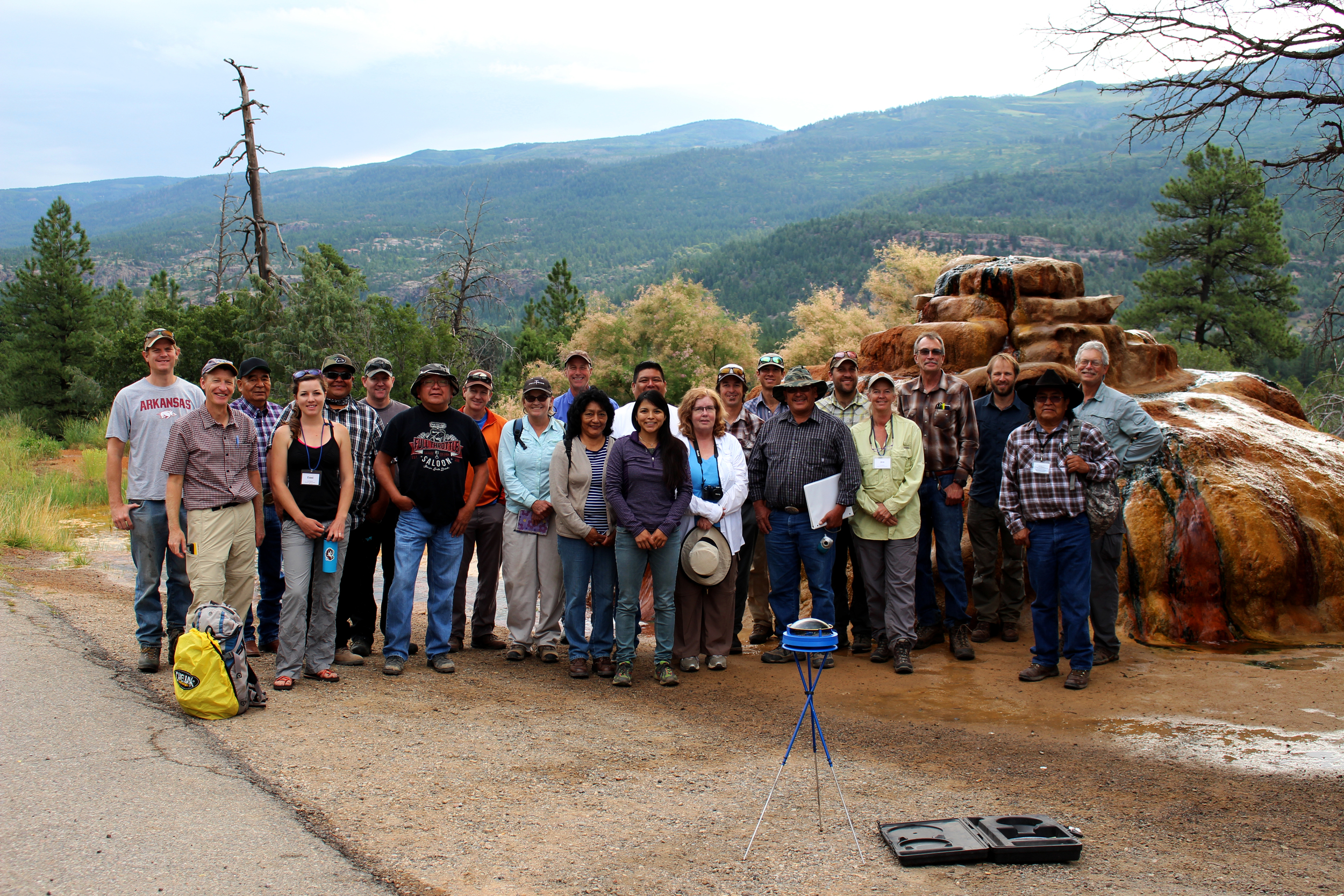
SSI staff with workshop participants at a (carbonate) mound-form spring surveyed during a training held in Durango, Colorado 2015.
SSI strives to provide a central repository and web portal for springs research and geocollaboration. We developed an online application to easily enter, archive, and report on information about flow, water quality, geomorphology, flora, fauna, habitat, human influences, and management concerns (http://springsdata.org/). Our SDE geodatabase is linked to the non-spatial data in the online application through a common Site ID. Our GIS analyst, Jeff Jenness, has developed tools to refresh our geodatabase with data contributed by our more than 800 users. He has also developed tools to import new datasets, reconcile duplicates, and automatically update fields such as distance to the nearest spring, land ownership, and elevation. The non-spatial database can be linked to the geodatabase to depict the location and local and regional contexts of the springs, and to allow for spatial analysis. Access to GIS technology is fundamental to achieving this goal.